Wij zijn bereikbaar per METRO
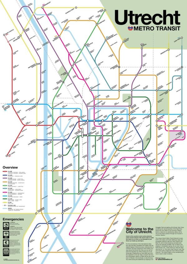
Laatst gewijzigd:Gelukkig is er de Metro**! Gemeente Utrecht heeft tijdens Corona niet stil gezeten. Er is door de bouwvakkers hard gewerkt en nu is er onder de grond een compleet netwerk met een metro station Metaal Kathedraal.
——————
Welcome to the City of Utrecht, home to the country’s most overly extensive metro transit network. We weren’t able to make the trains run on time, so we decided to just throw our hands up and dig in.
For the convenience of the international visitor, this map has been translated into English with the highest degree of literal accuracy, ensuring that no confusion will arise whatsoever when finding your way around the Dumb City. Now you too can explore this beautiful city without being put on the wrong leg or feeling like you have been sent from the cupboard to the wall.
Take a smooth ride from the northwestern district of Pillars all the way to the town of Woods in the southeast, or skip the busy city centre during the weekends by hopping on at Smaggler Field and getting off at Empty Yard. Enjoy pondering the natural beauties of the Fight River going over your head on your journey to Marshpants, or leave for an adventurous detour all the way to the exotic postwar through-sun-houses in southern Newfun.
The unique Utrecht Metro Transit Network is available both to the weary commuter seeking an easy and accessible method to get from Atom Road to the Bear Pit, and to those audacious pioneers looking for the road less travelled. Pay no heed to the sceptics in Amsterdam saying ‘do you even have a North-South Line’, ‘what would you need ten separate lines for’ or ‘this metro map thing isn’t real, they can’t even build a single tram track without budget overruns’. The Utrecht Metro is truly something you have to see in order to believe.
**Fictional Map of a Theoretical (yet Highly Improbable) Subway Map of the Dutch City of Utrecht**
